Research
Water Cycle and Ecohydrology
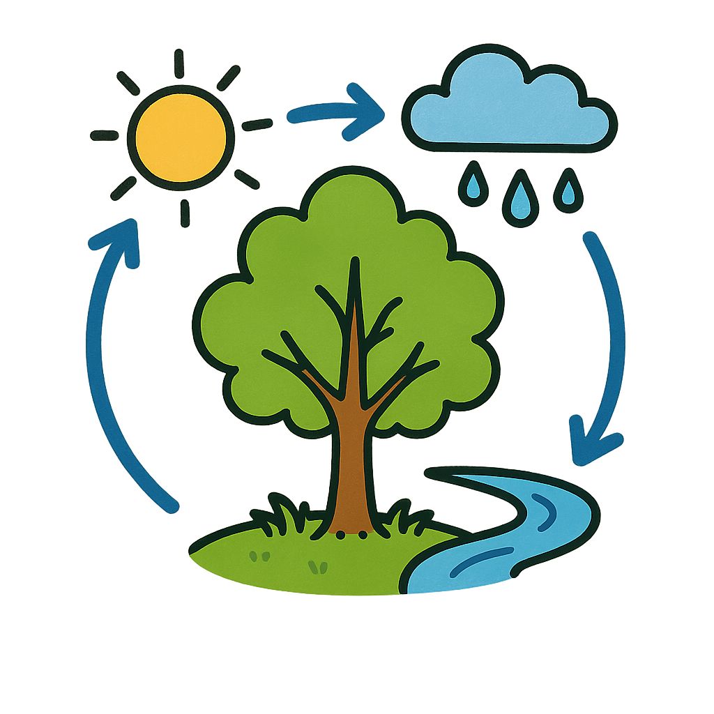
Understanding the Changing Global Water Cycle
The team investigates how global warming and human activities are altering fundamental water cycle processes. They seek to reconcile different data sources (like satellite, model (such as PML-V2 evapotranspiration and HBV-PML hydrological models), and ground observations) to better quantify these changes, asking critical questions such as why parts of the water cycle appear to be stagnating despite warming, and how human actions reshape water availability and ecosystem functions—like the roles of forests as "sponges" or "pumps"—at regional and global scales.
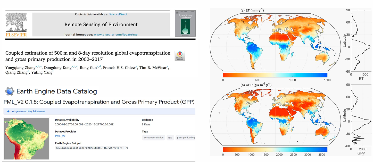
PML_v2
Penman-Monteith-Leuning Evapotranspiration V2 (PML_V2) products include evapotranspiration (ET), its three components, and gross primary production (GPP) at 500m and 8-day resolution during 2000-2023.
Related Publications
HBV-PML
The HBV-PML model provides critical data support for global water resource assessments. This innovative model integrates the remote sensing evapotranspiration model PML with the classical hydrological model HBV, significantly improving the accuracy of evapotranspiration simulation through remote sensing observations. It effectively overcomes the limitations of traditional models in representing vegetation dynamics.

Water-Related Disasters and Security
Under Climate Change
This theme focuses on the mechanisms and impacts of extreme hydrological events, including droughts and floods. The group studies how droughts develop and propagate through different environmental layers, how flood patterns have evolved in China over decades, and how to enhance societal and ecological resilience to water-related extremes in a changing climate.
Forest Fire & Flood Ecological-Hydrological Effects
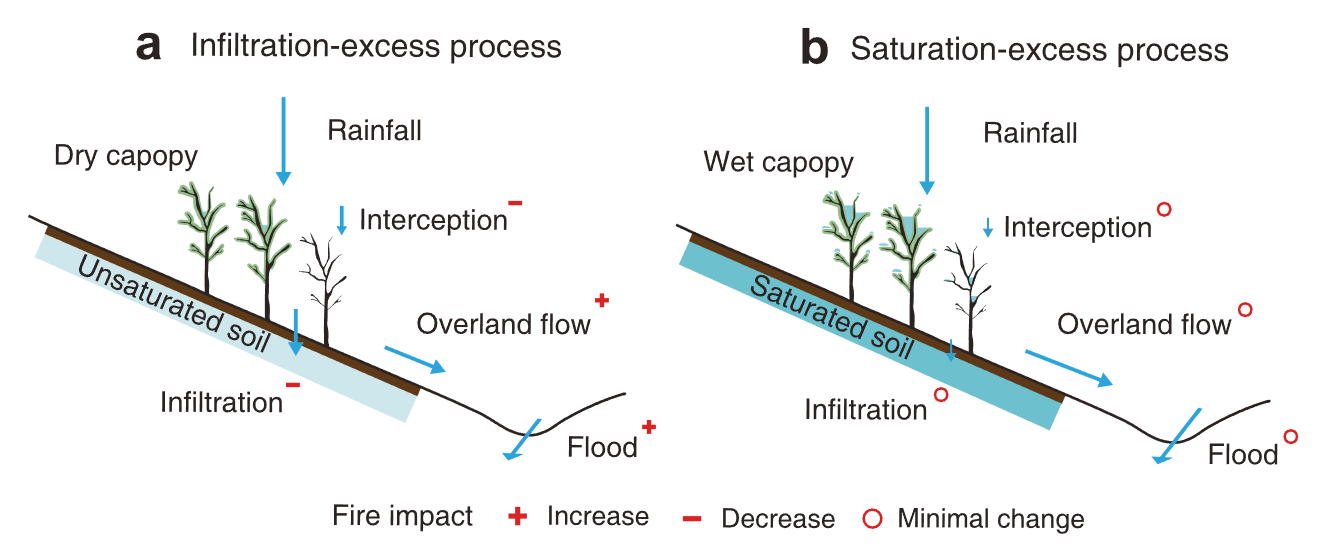
The research explores the impacts of bushfires on hydrological processes in southeast Australia, particularly focusing on changes in water balance and flood magnitudes. One study examines the effects of the 2009 Victorian Bushfires on water balance in eight forested catchments, finding a reduction in evapotranspiration and an increase in streamflow, leading to a long-term decline in water storage in burned areas. Another study investigates the 2019-2020 mega forest fires, showing that these fires significantly amplified flood magnitudes, especially in regions with winter-dominated rainfall.
Related Publications
Innovating Water Science
with New Technologies and Models
The group leverages advanced technologies such as high-resolution remote sensing and artificial intelligence (AI) to improve the monitoring and prediction of hydrological processes. They develop fine-scale datasets for evapotranspiration and vegetation productivity, integrate AI with physical models to enable better forecasting in ungauged basins, and work toward real-time flood prediction systems that support water resources management under climate change.
AI for Hydrology Modeling
We introduce an AI-driven Transformer-based deep learning model to address data gaps in GRACE and GRACE Follow-On satellite data. By integrating meteorological and hydrological features like temperature, precipitation, and evapotranspiration, the model effectively fills the 11-month data gap, showing superior accuracy, particularly in arid regions. The transformer-based approach outperforms traditional methods, demonstrating the potential of AI in enhancing satellite data continuity and reliability for environmental monitoring.
Related Publications

CAS-Canglong
We present a novel AI-based approach for sub-seasonal to seasonal (S2S) global sea surface temperature (SST) prediction, using a 3D Transformer model called CAS-Canglong. By leveraging the self-attention mechanism inherent in Transformer architectures, the model efficiently handles the complexities of ocean-atmosphere interactions and improves prediction accuracy. Compared to traditional physics-based models, CAS-Canglong demonstrates superior skill in predicting SST patterns, enhancing computational efficiency and forecasting accuracy for up to three months in advance. This approach shows great potential for improving predictions of extreme weather events like droughts and floods, as well as for future climate studies.
Related Publications